Landscape

Use A Billion Dollars Worth Of Technology To Enhance Your Photography!!!
(See Other Resources Covered at bottom of page.)


Smart App BOOTCAMP!!!
During the Nightscape Photography Conference in Moab Utah May 1-2-3.
I will be taking a small contingent of 16 individuals into a classroom setting for a concentrated Smart App Seminar.
I strip out all the crap and show you the cream of the crop. I show you which apps are worth your time and which I use before, during, and after a trip. Everything you need to know except the photography.
Segment One: Navigation. (4 AppsCovered)
First off, I show you how to orientate your smart phone. We will track multiple paths, drop some waypoints and take a few photos within the app for documentary purposes. I show you how to download offline maps and waypoints then track your way right to any location. NO CELLULAR SIGNAL NEEDED!!!
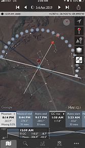
Then I reveal how to plan a Milky Way alignment with Photopills. I expose a hugely overlooked feature and verify that alignment with “The Photographers Ephemeris.” and then show you how to find polaris with an app (for star trails.)
Segment Two: Advanced Weather Prediction. (6AppsCovered)
This has been key in my photography, like real estate it’s all about location, location, location, except in nightscaping it’s all about location and timing.
I will show you how to check the weather and determine what locations will be best for your intent at the end of the day. Teaches the use of weather and radar apps and web resources that I use to predict what the clouds will be like at sunset.
i.e. Strip away all clouds on the radar above 5k feet and see what will happen at the horizon during sunset or where to expect to see a rainbow using an app and much much more.
Then I show you how to set up your phone to be notified of interesting weather events that are happening. Lightning strikes, flash flooding, and other special weather alerts. All indicating dramatic weather within your predetermined radius. especially useful for storm-chasing.
Segment Three: Now What?
The seminar is not over my friends, after we collect all this data, I then show you how to keep it organized on your computer. (Knowledge isn’t useful unless it can be easily accessed). Covers computer tips that are very useful to photographers, like easy culling techniques and organizational shortcuts, from importing KML files to Google Earth and exporting them to yourself and sharing them with others, and cataloging your sites for easy retrieval in the field. Even organization of physical materials collected during your trip (Maps,info,and photos) and best ways to stay connected while out in the field.
I know it’s a lot of info to absorb, so thirty days of free tech support from the “Adventure Photography Network” is included in the cost of your tuition!!! (just to make sure you’ve got it down).
I give away the farm in this 1.5 hour Mini-Worshop!! (I will send you an email to prepare you for the course.)
Sign up for your spot today, before they are all gone!!!
Price $100
Thursday May 2nd......4:30-6:00pm>>>>SOLD OUT.....In 5 hours.
Due to the overwhelming response to this course I have added a second workshop.
2nd Workshop
Friday May 3rd............7:00pm-9:00pm
To register, or for more info click the link below and send me an email.
Eric Gail
Click here to register
Other Resources Covered During Seminar


Follow me on Instagram,&Flickr